Transforming Agriculture in Europe through Data

Transforming Agriculture in Europe through Data

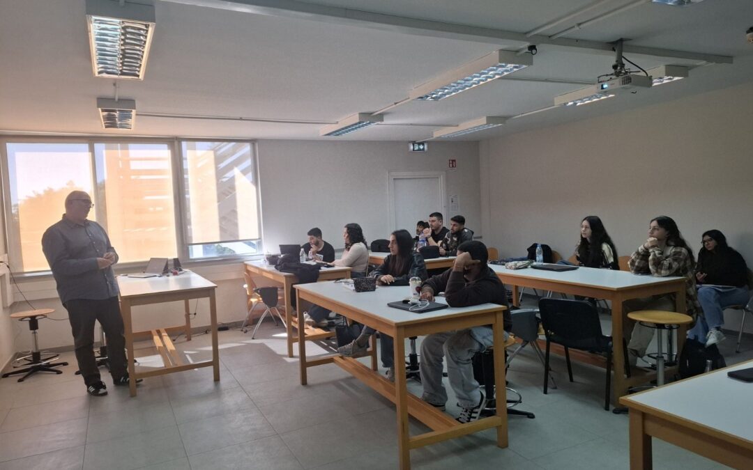
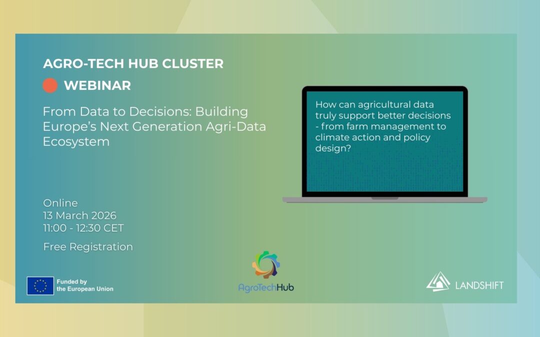
On the 13th of March, the AgroTech Hub Cluster, consisting of six leading Horizon Europe projects including LandShift, NOSTRADAMUSAgrarianOpenAgriENFORCE, as well as EARTHONE, hosted a joint webinar titled ‘From Data to Decisions: Building Europe’s Next-Generation Agri-data Ecosystem’. As the Agricultural sector in Europe is being increasingly transformed by the availability of vast amounts of data from satellites, sensors, models, and digital platforms, ensuring that this translates into maximum impact is crucial. For that reason, the event explored how emerging technologies, data infrastructures, and collaborative research can help transform large volumes of agricultural and environmental data into practical insights for farmers, policymakers, and land managers. 

The AgroTech Hub Cluster in a Nutshell  

All projects within the cluster contribute to strengthening Europe’s agri-data ecosystem. Their work focuses on improving how agricultural data is collected, shared, and analysed enabling new decision-support tools while supporting policy frameworks that promote sustainable, data-driven land management. Initially, the cluster was created to improve knowledge exchange among research and innovation teams, align efforts and avoid overlap across projects, develop shared activities that raise visibility and encourage collaboration, and support practical pathways for data-driven, nature-based solutions. Webinars like the one on Friday are precisely how the Cluster strives to do so in practice.  

Aggregating and Integrating Environmental Data for Decision-Making Support 

The webinar opened with a presentation from the NOSTRADAMUS project, which led the organisation of the webinar. NOSTRADAMUS focuses on developing a unified digital platform that integrates diverse agricultural data sources, including Earth Observation data, IoT sensor measurements, market information, and existing agricultural databases. Project representative Ioannis Varvaris, researcher and Deputy Research Coordinator at the ERATOSTHENES Centre of Excellence, highlighted the broader challenges driving the development of such infrastructures. These include supply-chain disruptions, volatile energy and fertiliser markets, and the impacts of geopolitical instability, such as the war in Ukraine on food security. At the same time, he pointed to strong policy momentum in Europe, including initiatives such as the European Green Deal,  Common Agricultural Policy (CAP) Modernisation, the Directive on Soil Monitoring and Resilience, and the development of a European agricultural data space. Against this backdrop, NOSTRADAMUS aims to help transform fragmented data sources into practical tools for agricultural decision-making and policy support. 

LandShift was represented by Dimitrios Koumoulidis, Assistant Researcher and PhD Candidate at the ERATOSTHENES Centre of Excellence, who gave a brief overview of the project and its objectives, and then delved into what data is collected and how it is aggregated into an applicable formula. LandShift integrates Satellite EO Data, in-situ measurements, existing open-access databases, National and EU institutional Datasets, historical datasets, and crowdsourced observations, and organises them into a structured system that allows them to be analysed together. Based on this data, indicators are developed to measure the impact of land-use decisions across environmental, social, and economic dimensions. Trade-off analytics and scenario pathways, in turn, help decision-making.  

Figure 2: Presentation on LandShift by Dimitrios Koumoulidis

Meanwhile, the project EARTHONE also works to support better decision-making through making data more readily available. Borya Arroyo Galenda, Scientific Coordinator of EARTHONE and leader of its agroforestry lab, focused on the projects role in studying greenhouse gas emissions through field sensors, laboratory analysis, and environmental monitoring technologies to generate detailed data on soil, climate, and ecosystem conditions. These datasets are integrated and made openly available through a central platform, supporting researchers, policymakers, and land managers in making more informed decisions about land use and environmental management. 

Bringing new Digital Tools to Farmers  

Several of the projects presented at the webinar focused on technological approaches that bring data-driven decision-making closer to farmers. Agrarian, represented by Miguel Cachão, an agronomic engineer based at the farmers’ consultancy  AVIPE, aims to support real-time farm management by bringing digital intelligence directly to the field. Instead of relying solely on distant cloud systems, Agrarian processes data locally using sensors, drones, and connected devices. This allows farmers to receive fast and reliable insights, even in rural areas with limited internet connectivity. 

Similarly, the project OpenAgri too works to bring digital agriculture tools to farmers by making these more accessible. Project Presenter Felipe Arruda Pontes, who is a postdoc researcher at Maastricht University, discussed how through open standards and collaboration with farmers across Europe, the project supports the development and testing of practical open-source digital farming solutions that can work even in regions with limited connectivity, helping farmers adopt data-driven practices more easily. 

Including Citizens in Environmental Data Collection  

Beyond improving agricultural technologies, some projects in the cluster also address the governance and regulatory aspects of environmental data. Anna Aseeva, Policy and Sustainability Expert at Digital for Planet, presented on how the project ENFORCE explores how digital monitoring tools and citizen science can support environmental compliance and enforcement. By transforming citizen-generated environmental data into reliable evidence, ENFORCE helps bridge the gap between locally collected environmental information and the requirements of regulatory authorities.  

Shared ambition and collaboration 

Together, the projects presented during the webinar highlight a shared ambition: to ensure that agricultural and environmental data is not only collected but also effectively used to support decision-making. While each project approaches this challenge from a different angle, whether through building data infrastructures, developing digital tools for farmers, improving data accessibility, or strengthening governance frameworks, they collectively contribute to a more unified agri-data ecosystem. 

PRESS CONTACT

For more information, press materials, or interview requests, please contact:

White Research

Dissemination & Communication Manager,

Nikolaos Sotiriou: [email protected]

Eva Steinhorst: [email protected]

Introducing the NEB and LandShift to Spatial Planning Students in Cyprus

Introducing the NEB and LandShift to Spatial Planning Students in Cyprus

On Thursday the 19th of February, Dimitris Koumoulidis, Assistant Researcher at the ERATOSTHENES Centre of Excellence which coordinates LandShift, gave a lecture to students of the Department of Civil Engineering and Geomatics at the Cyprus University of Technology as part of their course on Spatial Planning.

The session revolved around the New European Bauhaus (NEB) and its relevance for spatial development, sustainability, and inclusive planning. The NEB is a policy and funding initiative launched by the European Commission in 2020, with the goal to make the green transition attractive, inclusive and sustainable while respecting the diverse cultural  and geographic landscapes in Europe and beyond. The NEB is rooted within the original Bauhaus movement centred around functional beauty and social purpose, whilst introducing ecological sustainability as an essential new component. It is a vision for social transformation which is expected to be implemented in a number of different sectors including spatial and urban planning, construction and architecture, design, agriculture and environmental conservation as well as various others.  

The lecture took a close look at the case of Cyprus, which is confronted with significant challenges specifically in relation to land use and land cover modification, urban sprawl, and climate pressures which underscores the importance for unified, data-centric territorial planning – a topic which Dimitrios has already written about in various scientific publications. More centralised data can improve the management of infrastructure and resources, as well as support climate change adaptation and mitigation strategies.

As part of the lecture, Dimitrios also took the opportunity to introduce LandShift, as a project that is rooted in the principles of the New European Bauhaus and which collects  environmental observation data while also introducing new tools that help make existing data and research accessible and integrate it into useful formulas aligned with land-use decision-making priorities. Dimitrios, alongside Landshift’s scientific coordinator Ioannis Varvaris and a number of other researchers, have already published Research Paper within the framework of the project, examining the legislative structures shaping land-use in the project’s five Use Cases. The study analyses patterns, barriers and opportunities of current legal frameworks.

What is unique about LandShift, is its approach that pays strong attention to the contextual realities within the Living Spaces it operates in. Beyond EU level climate objectives, it integrates regional, national and local objectives. That being said, LandShift is not only a so-called Lighthouse case demonstrating what it takes in practice to integrate the NEB principles, it also provides a relevant case study for students of spatial planning. As climate pressures intensify, future spatial planners will need to be interdisciplinary and innovative thinkers, mediating between scientific data, complex regulatory frameworks, policy, as well as governance processes.

PRESS CONTACT

For more information, press materials, or interview requests, please contact:

White Research

Dissemination & Communication Manager,

Nikolaos Sotiriou: [email protected]

Eva Steinhorst: [email protected]

Celebrating the Launch of the Nature-based Solutions (NbS) Library

Celebrating the Launch of the Nature-based Solutions (NbS) Library

LandShift is proud to announce the launch of its Nature-Based Solutions (NbS) Library, an open-access digital repository of implemented European nature-based solutions designed to support regional land-use strategy development. Sixteen months into the project, this milestone marks an important step in translating LandShift’s analytical work into practical, deployable action.

This critical task has been undertaken by a dedicated team from the the core LandShift partner Metabolic Institute working at the intersection of academic research and real-world experimentation.

Why this matters now

Europe’s climate and biodiversity ambitions are clear. Delivering them, however, depends not only on targets and regulatory frameworks, but on the availability of concrete, tested solutions that can be realistically deployed across diverse regional contexts. As Member States work to meet commitments under the revised LULUCF Regulation and related climate and nature restoration policies, the central challenge lies in moving from strategic objectives to implementable action on the ground.

Nature-based solutions offer a powerful pathway forward. As defined by the European Commission, they are actions to protect, manage, and restore ecosystems in ways that are grounded in nature and designed to generate environmental, social, and economic benefits. Whether through restorative agricultural practices, wetland restoration, or landscape-level ecosystem management, NbS can simultaneously contribute to carbon sequestration, biodiversity recovery, food system resilience, and rural development.

Yet despite their recognised potential, the application of NbS often remains fragmented. Policymakers and regional planners face constraints related to evidence, transferability, feasibility, and alignment with local conditions. What works in one region cannot simply be replicated in another without understanding its ecological, socio-economic, and governance context.

The LandShift NbS Library was created precisely to address this implementation gap.

What is the LandShift NbS Library

The LandShift NbS Library is far more than a compilation of scientific work. It is an interactive digital collection built on the systematic identification and rigorous curation of implemented NbS cases across Europe. Each case is classified by ecosystem type, land-use challenge, and NbS approach, enabling users to conduct targeted searches and strategic comparisons.

Within the LandShift project, the NbS Library plays a fundamental role, as Antoine Coudard, Bioeconomy Lead at Metabolic Institute, explains:

“The Nature-Based Solutions Library is designed as a practical resource for the five LandShift Living Spaces as they develop their future territorial land-use strategies. Its core function is to provide concrete examples of implemented nature-based solutions that regions can draw inspiration from when identifying and selecting interventions for deployment. While LandShift analyses land-use change, climate impacts, and future scenarios, the Library supports the next step: translating these insights into actionable options. It offers a structured set of real-world solutions that regional stakeholders can consider, adapt, and integrate into their climate-resilient land-use strategies.”   

The Library was developed through close dialogue with representatives from the Living Spaces, ensuring that it directly responds to the concrete challenges faced in these regions and their respective ecosystems. The case studies featured address land degradation, biodiversity loss, and degradation of water bodies, as well as challenges related to climate extremes, urbanisation pressures, an other context-specific issues. 

What makes the LandShift NbS Library unique

Over the past decade, numerous NbS databases and knowledge hubs have emerged. The LandShift NbS Library distinguishes itself in three key ways:

  • Focus on implemented cases rather than conceptual or early-stage pilots
  • European relevance, ensuring transferability to EU land-use planning contexts
  • Structured curation, allowing users to filter solutions by ecosystem, challenge, and approach

As Antoine highlights:

“Many existing NbS platforms include conceptual approaches, early-stage pilots, or global examples that may not be directly transferable to European land-use planning contexts. The cases featured here go beyond theory and small-scale pilots. They represent interventions that have already been implemented and can offer tangible lessons for regional decision-makers. By concentrating on European experiences, the Library increases relevance, transferability, and policy alignment.”

Besides that, the many libraries that exist all focus on different purposes and vary depending on context, geography, how and for whom they were curated, and thematic focus, which further underscores the need for an NbS library tailored to the LandShift project. By focusing on European contexts, this library strengthens its practical value and ensures closer alignment with regional planning needs and EU policy frameworks. A clear example of this approach is its planned integration of the principles of the New European Bauhaus (NEB), an initiative launched by the European Commission with the goal of making the green transition sustainable, inclusive, and beautiful. As Antoine notes:

“In future editions, it will also integrate principles of the New European Bauhaus, creating one of the first structured bridges between environmental performance, social inclusion, and aesthetic quality within a nature-based solutions platform.”

Designed for real-world use

The NbS Library is designed as an open, user-friendly exploration tool. It eliminates the need to navigate extensive academic literature by providing accessible, curated examples grounded in documented experience.

Regional authorities, planners, and local stakeholders can use it during strategy development and stakeholder discussions to:

  • Compare approaches implemented elsewhere in Europe
  • Identify solutions relevant to specific land-use challenges
  • Ground decisions in documented, real-world experience

As Antoine explains:

“We expect regional authorities, planners, and local stakeholders to use the Library during strategy development and stakeholder discussions. It can help them compare approaches implemented elsewhere in Europe, identify solutions relevant to their specific land-use challenges, and ground their decisions in documented experience.”

However, it is not only a shared resource for public authorities, as he elaborates: 

“Beyond public authorities, practitioners, researchers, NGOs, and community groups may also use the Library to access credible examples and reliable sources that support climate-resilient and biodiversity-friendly land management.”

Importantly, the Library itself is not static. It is designed to evolve, responding to the needs of the Living Spaces and progressively integrating additional dimensions, including NEB principles. 

The NbS can be accessed here: https://landshift-nbs-library.webflow.io/

PRESS CONTACT

For more information, press materials, or interview requests, please contact:

White Research

Dissemination & Communication Manager,

Nikolaos Sotiriou: [email protected]

Eva Steinhorst: [email protected]

AgroTech Hub Webinar #1

AgroTech Hub Webinar #1

Date: March 13, 2024

Online

Time: 11:00 – 12:30 

The session will explore how diverse agri-data sources can be transformed into actionable insights, covering AI-ready Copernicus data and data cubes, land-use and climate modelling, farm-level decision-support tools, open platforms and interoperability, validation and policy relevance, and understanding GHG emission drivers across Europe. Experts from Horizon Europe initiatives such as NOSTRADAMUS, LandShift, Agrarian, OpenAgri, ENFORCE, and EARTHONE will share perspectives on governance, usability, trust, and collaboration to strengthen Europe’s agri-data ecosystem.

👉Register for the event here: https://www.f6s.com/agrotech-hub-webinar-1/ 


Press Release #3

Press Release #3

BRUSSELS, JANUARY 2026

Transforming land-use management to meet Europe’s climate, biodiversity, and food system goals remains a complex challenge. Competing demands for land, fragmented governance frameworks, and limited integration of local perspectives often hinder the transition towards climate-resilient and inclusive land-use solutions.

The Horizon Europe project LandShift addresses these challenges through a community-led, place-based approach that puts people, nature, and science at the centre of land-use decision-making.

To introduce its mission and vision to a wider audience, LandShift has released a new promotional video, now available on YouTube. The video provides a clear and accessible overview of the project’s objectives, its five Living Spaces, and the innovative methods used to co-create sustainable land-use pathways across Europe.

FROM RESEARCH TO REAL LANDSCAPES

The LandShift promotional video highlights how the project moves beyond abstract policy discussions by working directly within five Living Spaces in France, Greece, Italy, Poland, and Ukraine. These Living Spaces function as real-world environments where local communities, researchers, policymakers, and practitioners collaborate to design, test, and govern Nature-Based Solutions tailored to local needs and conditions.

Through the video, viewers can discover how LandShift:

  • Brings together local knowledge, scientific research, and policy expertise
  • Uses Earth Observation data, artificial intelligence, and advanced monitoring tools to support evidence-based land-use planning
  • Applies the principles of the New European Bauhaus, combining sustainability, inclusiveness, and aesthetics
  • Supports balanced solutions that address climate mitigation and adaptation, biodiversity protection, and sustainable food and biomass production

Together, these elements form a coherent framework for climate-resilient land-use management that can be adapted and replicated across Europe.

DESIGNED TO BE WATCHED, SHARED AND ENGAGED WITH

The promotional video is designed as an entry point for a broad range of audiences, including policymakers, regional authorities, researchers, practitioners, and citizens. Rather than presenting technical detail, it invites viewers to understand the why, how, and where of LandShift, and to follow the project as insights and results begin to emerge from the Living Spaces.

By making this video openly available, LandShift reinforces its commitment to transparency, knowledge sharing, and public engagement, encouraging stakeholders to follow the project’s progress and take part in the wider conversation on Europe’s land-use future.

WATCH THE LANDSHIFT PROMOTIONAL VIDEO

The LandShift promotional video is freely available to all interested audiences:

🔗 Watch the video on YouTube: https://www.youtube.com/watch?v=RVAwzH_FtuI  

Viewers are encouraged to watch, share, and explore how community-led approaches can help shape resilient, inclusive, and sustainable landscapes across Europe.

MORE ABOUT LANDSHIFT

The alarming decline in net removals within the LULUCF (Land Use, Land Use Change, and Forestry) sector presents a significant challenge to advancing climate mitigation efforts. However, the sector offers considerable untapped potential for driving climate action through integrated strategies. By harnessing the diverse dimensions of land use and management, co-created solutions can be developed to enhance carbon sequestration and strengthen ecosystem resilience.

To address these challenges, LandShift introduces a comprehensive framework aimed at supporting the co-development of regional strategic roadmaps that effectively balance socio-economic and environmental objectives. Through a synergistic and cohesive approach, LandShift aligns with all relevant European Union key policies, such as the European Green Deal and New European Bauhaus (NEB), working to achieve climate neutrality and assist in the EU’s goal of removing 310 million tons of CO2 by 2030 through land-based actions and community collaboration.

PRESS CONTACT

For more information, press materials, or interview requests, please contact:

Nikolaos Sotiriou

Dissemination & Communication Manager,

White Research

[email protected] 

Living Space Spotlight: Kiev Region, Ukraine

Living Space Spotlight: Kiev Region, Ukraine

The Kyiv region surrounds Ukraine’s capital and brings together dense commuter belts, expanding suburbs, peri-urban villages and large rural landscapes. Forests, wetlands, river valleys, productive farmland and the polluted Chornobyl exclusion zone all coexist within its boundaries. This unique mix makes the region both a hotspot of post-war reconstruction and development pressure, and a promising Living Space for testing climate-resilient, nature-based solutions in a metropolitan context.

A Region Where City and Countryside Intersect

Kyiv region is characterised by a fluid boundary between metropolitan Kyiv and its surrounding rural areas. Thousands of people commute daily from small towns and villages, while new housing, logistics facilities and transport corridors continue to expand into former fields and forests.
Despite this rapid growth, the region still hosts valuable natural areas — river valleys, wetlands and forests that regulate water, cool urban areas and provide much-needed recreation. These landscape elements form the ecological backbone of the wider metropolitan area.

Environmental Challenges and Local Needs

Kyiv region faces multiple and overlapping pressures. Post-war restoration requires finding safe, sustainable uses for damaged lands, while rapid and often uncoordinated suburban expansion creates new infrastructure bottlenecks and contributes to deforestation. Rivers and wetlands are drying, and built-up areas are experiencing rising heat stress. Together, these trends erode critical ecosystem services and increase risks for local communities, creating an urgent need for coordinated and climate-resilient land-use approaches.

How LandShift Is Helping

LandShift enables actors to work with shared maps, data and future scenarios to better understand how development choices affect water systems, heat stress, land-take and ecosystem performance. Using project tools, partners can test nature-based solutions such as restoring drained or damaged areas, creating green-blue corridors and exploring alternative development paths.
This shared evidence base supports more coherent spatial planning and more informed decisions on post-war investment and reconstruction.

Community Involvement and Collaboration

The kick-off meeting revealed a strong readiness among participants—from local government to the academic sector—to collaborate on innovative approaches for achieving climate neutrality and protecting biodiversity. This willingness to work together across institutional boundaries has been one of the most rewarding aspects so far, setting the stage for deeper cooperation.

A Strong Regional Network of Actors

The Kyiv Living Space brings together regional and local authorities, land-use and environmental departments, researchers from the National University of Life and Environmental Sciences of Ukraine and other scientific institutes, innovative mapping and land-development companies, civil-society organisations such as the Union of Land Managers of Ukraine, environmental bodies including the Chornobyl Biosphere Reserve, and local and regional media such as Kyivvlada.
This broad coalition reflects the complexity of managing land in a region where ecological, social and economic pressures intersect.

Vision and Next Steps

The Kyiv Living Space aims to turn the region into a leading example of climate-resilient metropolitan development in Ukraine. Pilot projects on restored lands, protected forests and wetlands, and greener new housing areas are expected to offer practical models for other regions and inform national policies on land management and reconstruction

PRESS CONTACT

For more information, press materials, or interview requests, please contact:

Nikolaos Sotiriou

Dissemination & Communication Manager,

White Research

[email protected]